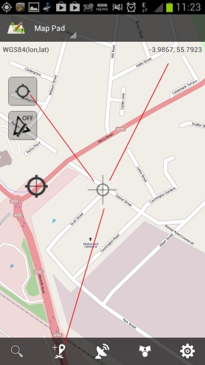
After the MapPad application is opened following screen will be shown: The map is covered by the action bar (upper and lower) where you can access common functions:
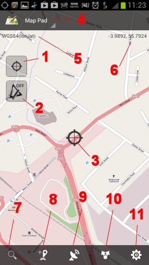
1. Center on GPS location ON/OFF button
When you click on it the ‘Center on GPS’ will be disabled and you will be able to pan around. This option can be accessed and set as well in the Settings>General Settings>Center on GPS location ON/OFF.
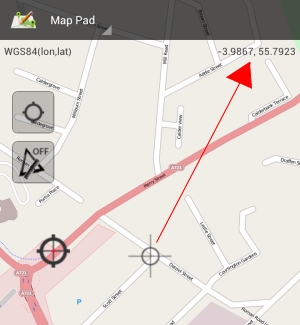
When you pan the coordinates will be changing to reflect the pointer Lat, Lon.
2. Measurement option ON or OFF
– When ‘SINGLE Click’ is performed the default ‘Length Measurement’ or last used measurement method is being activated and you can start the measurement. If minimum 2 points are added the line is being drawn and the length information displayed at the top of the screen.
– When ‘LONG Press’ is being performed on that button the following context menu will be displayed:
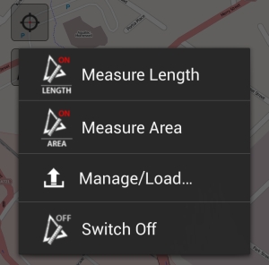
– Selected measurement method will determine the icon:

3. Center on GPS indicator
If the ‘center on GPS’ is enabled the coordinates displayed and points registered will be using current GPS position.
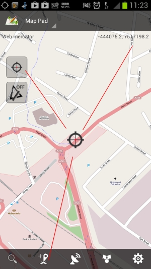
The other option is to switch the ‘Center on GPS’ off. In that case the cursor in the center of the map will change to the gray cross and points registered and coordinates displayed will be having location of the cursor on the map. This option is useful to add waypoints to the map before you actually go outside.
4. Basemap selector
At the moment 5 basemaps are supported:
– Open Street Map – Mapnik
– Open Street Map – Cycle
– Bing Map – Satellite View
– Bing Map – Satellite View and Roads
– Bing Map – Roads
5. Coordinates Spatial Reference
– EPSG:4326 – WGS84, World Geodetic System
– EPSG:3857 – WGS84 Web Mercator (Auxiliary Sphere). Projection used in many popular web mapping applications (Google/Bing/OpenStreetMap/etc.)
– EPSG:27700 – British National Grid [UK – Great Britain onshore; Isle of Man]
You can select the default coordinate system in Settings>General Settings>Default coordinate system.
Depending from the default coordinate system following coordinates might be displayed:
– Lon, Lat – for WGS84
– X,Y – for Web Mercator
– Easting Northing – For British National Grid
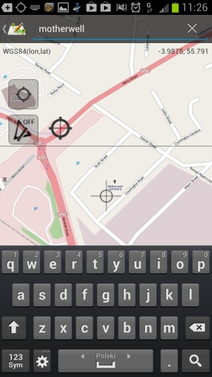
6. Search for address, place facility
Provide the name of the town or place followed by the country code like GB, US, PL etc. to limit the search results and get the proper location details.
When the place, town or address is found the ‘Center on GPS’ is disabled to allow cooperation with the map.
7. Add Point/Waypoint to the map
Depending if ‘Center on GPS’ is selected or not the points/waypoints added will be located at current GPS position or will reflect the current cursor location.
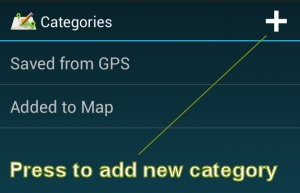
There is possibility of setting up the default category for newly created waypoints in Settings>Data Management. To add new categories or update existing ones please press ‘Tools’ [10] button and then from the sub-menu choose ‘Categories’. To add new category press the ‘+’ button in the top-right corner.
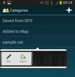
Please tap the Category item on the list to Edit or Export all the points.
10. Data Management/Export
11. Options/Settings


