Few weeks ago one of our users asked if it would be possible to change imported GPX track to polygon, so the area for the track could be calculated. This feature has been implemented in MapPad+ starting from version 1.9.8 (11-09-2013), so any imported GPX track can be converted to polygon.
If you decide to reverse the process, it is also possible.
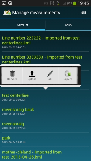
To change the geometry type please select particular measurement then press ‘Edit’ as shown on the picture below:
Press ‘Options’ button and select ‘Convert to Polygon’ or ‘Convert to Line’ in case you are editing polygon type.
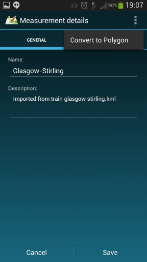
Following dialog window will be displayed:
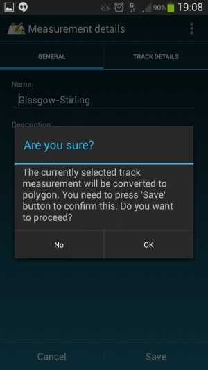
After pressing ‘OK’ and then ‘Save’ button selected measurement will be changed to Line or Polygon depending what was the initial geometry type.